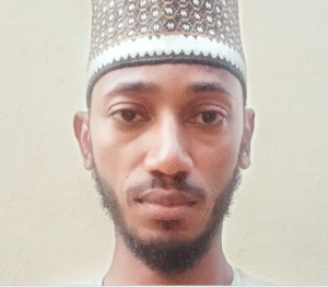
Muhammad Gidado Ibrahim is a dedicated Laboratory Technologist II at Kaduna State University (KASU) with a strong background in Geomatics. He holds a B.Sc. in Geomatics from Ahmadu Bello University, Zaria, and is passionate about precision mapping and spatial data analysis.
- About Us
- Academia
- Directories
- Academics
- Resit Examination
- Library
- Centers
- Center for Mentorship and Career Development Kaduna State University
- Center for Mosquito and Vector-Borne Disease Research
- The Centre Entrepreneurship and Research Development (ERDC)
- Center for Nutrition Research and Innovation
- Center For Biosecurity, Biosafety, Infectious Disease & One Health
- Centre for Energy and Environmental Strategy Research (CEESR)
- Center for Democracy and Good Governance (CDGG)
- Climate Research Group
- Centre for Soft Skills
- Colleges
- College of Art, Education, Humanities and Law
- College of Agriculture and Environmental Sciences
- College of Allied Health and Pharmaceutical Sciences
- College of Basic Studies and Continuing Education
- College of Communication, Management and Social Sciences
- College of Computing, Engineering and Sciences
- College of Medicine
- College of Postgraduate Studies
- Institutes
- KASU Online
- Admissions
- Campus Life
- Resource Hub
- Research
- Alumni

